
There’s an old saying about waste running downhill. In fact, that’s exactly how it gets to the wastewater treatment plant.
ALCOSAN has partnered with 3 Rivers Wet Weather to map all the sewer lines in their service area.
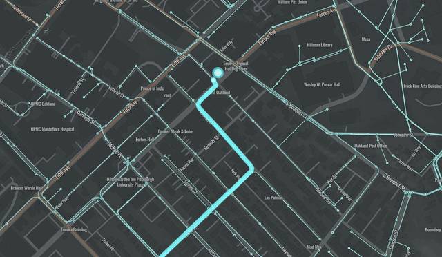
The resulting Follow the Flush interactive map allows the public to track the wastewater from their home, or any other address, to the ALCOSAN treatment plant in Pittsburgh’s North Side.
The graphic uses a colored line to represent the journey of your toilet flush or bath water, but it also includes the distance and time involved.
For example, a toilet flush at the Primanti Brothers in Oakland would travel 53,949 feet, or about 10 miles, from Forbes Avenue to the bank of the Ohio River. It would take between 7 and 15 hours for the waste to make the trip to ALCOSAN during typical dry weather, according to the site.

The project is powered by CivicMapper and displays infrastructure owned by ALCOSAN, municipaities and regionalized extents.
Try mapping your own flush at the authority’s website.