https://triblive.com/local/regional/arctic-air-headed-to-pittsburgh-area-6-8-inches-of-snow-in-forecast/
Updated winter storm forecast calls for less snow, more ice in Pittsburgh region

On Valentine’s Day, National Weather Service meteorologists predicted that the Pittsburgh region could once again be the victim of the dreaded “wintry mix,” when frigid air and heavy snow mix with warmer air and chilly rain to bring a coating of freezing rain.
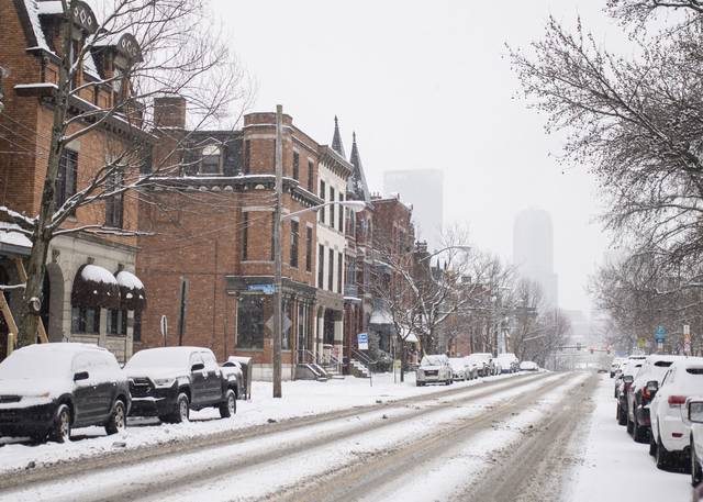
The Pittsburgh region can expect 2-4 inches of snow through Tuesday — a far cry from the nine inches forecast a few days ago — but freezing rain and the resulting ice accumulation could be just as dangerous, according to the National Weather Service.
“That can be just as much if not more problematic, due to ice accumulation on roadways, trees, power lines and things of that nature,” NWS meteorologist Jason Frazier said Monday morning.
A winter storm warning took effect 1 a.m. Monday and will remain in place until 1 p.m. Tuesday. This warning remained unchanged despite the lower expected snowfall total due to the heavy amount of freezing rain in the forecast, according to Frazier.
The forecast calls for up to a quarter-inch of ice accumulation.
**Afternoon Update** – The trend for a more western low track will allow more warm air to enter the region as precipitation returns later today. The result will be a decrease in snowfall totals and increase in ice.The Winter Storm Warnings and Advisories remain in effect. pic.twitter.com/YIDW8nJu0k
— NWS Pittsburgh (@NWSPittsburgh) February 15, 2021
“At one point it was looking more like a snow event, but warm air is getting a little bit stronger, moving a little bit farther north, so now we’re seeing more of a wintery mix with freezing rain accumulation,” he said.
The first wave of the storm moved through the region beginning overnight, bringing a coating of snow that was largely cleared away by the afternoon. In Westmoreland County, a 911 supervisor said calls were limited to minor slipping and sliding, with no injuries reported.
But the second wave of winter weather arrives between 5 and 6 p.m., according to the forecast.
“Things can change drastically around rush hour so leave early, if you can,” said NWS meteorologist Shannon Hefferan.
On Valentine’s Day, the icy start to the day was the result of freezing rain. It created dangerous road conditions, causing crashes and stranded vehicles across Southwestern Pennsylvania.
Frazier said the storm’s track, which is following a “V” shape from the West Coast to Texas and back up toward New England, is a strong push of cold Arctic air from Canada.
During its southbound detour, Frazier said, the storm is picking up warmer moisture from the Gulf of Mexico, and bringing it along the spine of the Appalachian Mountains. There, it will meet the frigid air that has settled in the Pittsburgh region.
“So there’s going to be a fight between the cold air that’s here and the warmer air moving north,” Frazier said.
Staff writers Tawnya Panizzi and Jacob Tierney contributed.
Copyright ©2026— Trib Total Media, LLC (TribLIVE.com)