The couple of inches of snow that hit the Pittsburgh region last week was minor compared to what is likely headed our way this weekend.
As of Friday morning, the National Weather Service in Moon was predicting heavy snow will begin falling in Southwestern Pennsylvania sometime Sunday afternoon and continue into Monday morning.
“The storm is splitting right across our area, which means that Allegheny County is likely to see between 6 and 8 inches of snow,” meteorologist Lee Hendricks said.
“The storm started in the plains and is pushing east before it moves to the northeast,” he said. “It’s going to bring in all kinds of moisture that will hit a pocket of cold air that will produce significant snowfall.”
A winter storm watch has been issued for the entire forecast area here in Upper Ohio Valley. A winter storm will move into the area on Sunday afternoon and is expected to drop several inches of snow by Monday morning. pic.twitter.com/St8AfuLIAq
— NWS Pittsburgh (@NWSPittsburgh) January 14, 2022
Not only is snow headed our way, but the storm will bring a burst of frigid temperatures. Friday’s high temperature of 37 is expected to drop to 15 degrees overnight with high of 24 on Saturday. The high for Sunday will be near 31 with temperatures in the 30s continuing for much of next week, according to the weather service’s seven-day forecast.
PennDOT officials said they will be following forecasts and talking to meteorologists with regard to any road conditions.
“We’re still developing our plan,” said Steve Cowan, spokesman for PennDOT’s District 11, which includes Allegheny, Beaver and Lawrence counties.
“We have a districtwide meeting (Friday) with our maintenance staff for Allegheny, Beaver and Lawrence Counties, and we also have a statewide conference call,” Cowan said. “Each district will lay out their plan for fighting the winter storm.”
Related:
• Pittsburgh officials say snow response will be better ahead of Sunday storm
• PennDOT, Alle-Kiski municipalities treat roads differently when the snow starts to fall
Cowan said snow removal operators have been told to expect to be working this weekend. Much of the preparation will depend on whether the storm comes in as rain or snow.
“We do not pretreat the roads when (a storm) starts out as rain. It’s salt brine, so it will just wash right off the roadway if the rain precedes the snow,” he said.
Looking beyond the weekend, Monday is the Martin Luther King Jr. holiday, so schools will be closed and traffic should be light.
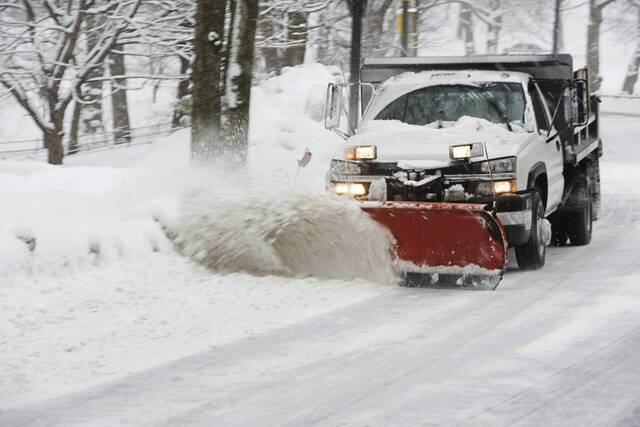
Allegheny County’s public works department officials on Friday said 30 salt trucks will be deployed when snow begins to fall and they will continue working along county-maintained roads until they are clear.
Drivers also will keep working beyond their shifts if needed until they can be replaced.
It typically takes two hours for a salt truck to complete its route plus an additional hour to restock the vehicle with salt.
Public works Director Stephen Shanley said the time it takes for a truck to complete a route plus the intensity of the snow that’s being predicted could make roads hazardous.
“If snow is falling quickly, there will be accumulation on our roads,” he said. “For that reason, we advise residents to avoid driving during the storm if possible.”
Traffic on the roadways also increases the time it takes for the trucks plowing and spreading salt.
Paul Guggenheimer is a Tribune-Review staff writer. You can contact Paul at 724-226-7706 or pguggenheimer@triblive.com. Tony LaRussa is a Tribune-Review staff writer. You can contact Tony at 724-772-6368, tlarussa@triblive.com or via Twitter @TonyLaRussaTrib.