https://triblive.com/local/regional/flash-flood-warnings-are-being-issued-in-w-pa-at-their-fastest-rate-in-20-years/
Flash flood warnings are being issued in W.Pa. at their fastest rate in 20 years

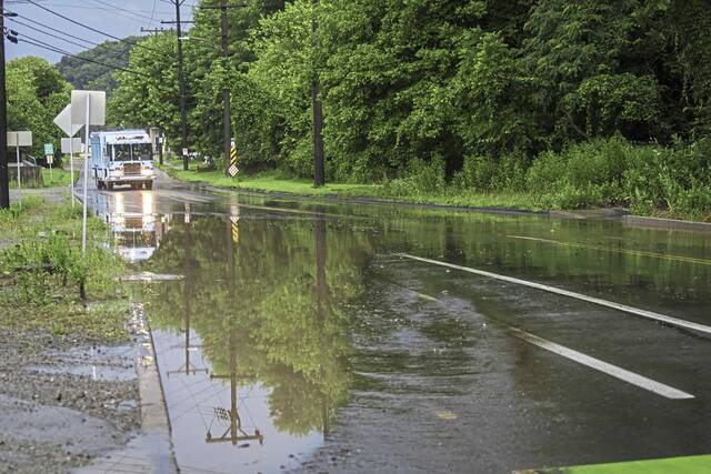
Western Pennsylvania has been awash in flash flood warnings this year.
The National Weather Service has issued 112 such warnings so far in 2025, Alicia Miller, hydrologist at the weather service in Moon, said Thursday. That’s more than the past three years combined and more than any year since 2003.
The culprit? Yes, climate change plays a factor, Miller said, citing in part a federal report released in 2017. But a dew point that is higher than at any time in the past 80 years and a jet stream that is keeping a volatile atmosphere over Western Pennsylvania are the main reasons.
“When we’ve had heavy rain, the rates have been very intense,” Miller said.
Moisture in the atmosphere is represented by the average dew point. From June 1 through July 13, the average dew point in the region has been about 63.5 degrees — its highest reading since 1945, according to weather service records.
The average dew point during that same span is 57.6 degrees, said National Weather Service meteorologist Jared Rackley. “Quite a bit above average compared to any other year,” he said of 2025.
The weather service has tracked the dew point since the 1940s.
“When we do have thunderstorms, they are pulling a lot of moisture, increasing the rainfall rates,” Miller said. “The rates are so intense, we are experiencing flash flooding fairly quickly in a lot of the region.”
The threat is expected to continue this weekend, said Mike Doll, senior meteorologist at State College-based AccuWeather. Though humidity will drop Friday, it will be back Saturday, with the possibility of thunderstorms — and flooding — Saturday and Sunday, he said.
“The one thing … we’ve been seeing is the amount of moisture that is available that the atmosphere can squeeze out and increase the potential and risk for heavy rain that can cause flooding,” he said. “That in and of itself is above normal — not only across Western Pennsylvania but across a good chunk of the United States.”
This has been trending upward for the past 30 years or more, Doll said.
“It’s definitely well above normal, and the trends are increasing,” he said. “They dump a lot of rain in a short period of time. That’s what we’ve seen in Western Pennsylvania.”
Severe weather is not out of the ordinary for this time of year. Peak flash flood season runs through June and July, Miller said.
“It’s still on the higher end for the season,” she said.
This summer’s weather has been a complete departure from last summer, when parts of Western Pennsylvania were experiencing drought-like conditions.
“We were very active in the spring season — flooding in April — and then all of the weather kind of skirted around us,” Miller said. “We did have a few flash flood warnings last year, but also we just didn’t have nearly the amount of thunderstorms that we’ve had (this year).”
Active weather pattern
The active weather pattern is influenced on a larger scale by La Niña/El Niño, a climate pattern in the Pacific Ocean that affects weather worldwide through jet streams and can bring severe weather, Miller said.
However, Western Pennsylvania this summer finds itself in between La Niña and El Niño, which Miller called a “neutral” pattern. This has caused “more variability” and frequency in active weather, she said.
“We are just in this very active — almost daily — rounds of showers and thunderstorms,” she said. “We get barely a break.”
From June 1 through Wednesday, 7.45 inches of rain had fallen at the region’s official measuring point at Pittsburgh International Airport, Miller said. That is an inch above normal. This summer season has been the 35th wettest on record, according to the National Weather Service.
“Obviously, (there have) been other areas with heavier rainfall,” Miller said. “An inch over (the normal) is a good amount.”
The amount of rain aligns with the rest of the nation’s weather, which is being influenced by climate change, according to the U.S. Global Change Research Program’s Climate Science Special Report released in 2017.
Heavy precipitation events across the United States have increased in intensity and frequency since 1901, particularly in the Northeast, because of climate change, Miller said. She cited the Global Change Research report, its latest such assessment available.
Doll said while he hasn’t seen anything to confirm or dispel a link with these extreme weather events to climate change, there likely is a connection.
“The state of the climate as it exists right now is different than it was 30 years ago,” he said. “Given all those factors, unless the state of the climate changes where we’re not as warm, we don’t have as much moisture, I think we’re going to continue to see … incidents of extreme flooding.”
Copyright ©2026— Trib Total Media, LLC (TribLIVE.com)
