


Meteorologists predict rain totals will be higher in regions south of Pittsburgh when the remnants of Hurricane Ida arrive in Western Pennsylvania.
After devastating parts of Louisiana, Hurricane Ida became a tropical storm as it began a northward journey Monday. Local officials in Western Pennsylvania began preparing for significant rainfall and potential flooding before Ida was set to arrive in the region Tuesday night.
The Pittsburgh region can expect to see between 2 to 4 inches of rain from Tuesday night through Wednesday evening, said National Weather Service meteorologist Myranda Fullerton. Areas east and south of Pittsburgh — including Westmoreland and Washington counties — will likely see similar amounts of precipitation.
“Generally speaking, the farther south you move into Allegheny County would be where the heavier rainfall amounts are anticipated,” Fullerton said. “It’s going to be a very warm, efficient rain process, which leads to higher rainfall rates.”
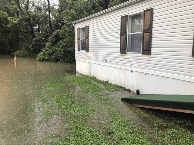
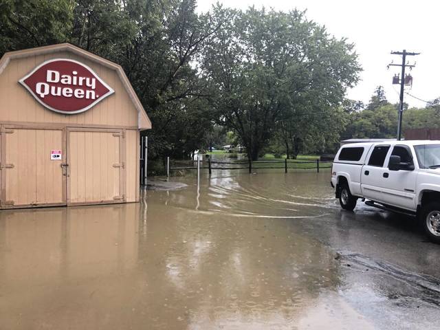
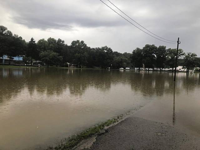
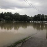
The rain Tuesday night caused flooding along Water Street in West Newton. It forced Amtrak’s Capital Limited, which runs between Washington, D.C. to Pittsburgh, to stop in West Newton around 10:15 p.m. Tuesday.
The National Weather Service anticipates that counties including Fayette and Greene will be hit with about 3 to 4 inches of rain by Wednesday night. In neighboring West Virginia, Ida could bring 4 to 6 inches of precipitation.
Northern portions of Allegheny County, along with Beaver, Butler and northern Armstrong counties, should about an inch of rain.
Much of the region — including Allegheny County — is under a flash flood watch that lasts through early Thursday morning. Even areas that aren’t expected to see the worst of the rainfall could be impacted by flash floods, Fullerton said, explaining that urban areas, places with poor drainage and locations near rivers or creeks are particularly prone to potential flooding.
Some rain had already started cropping up throughout the region by Tuesday morning, but those showers will become stronger and more widespread by midnight, Fullerton said.
After that, rain will continue to blanket Western Pennsylvania for much of the day Wednesday.
“Some of the models are showing some enhanced rainfall during your morning rush hour tomorrow through the afternoon — especially in the afternoon across southeastern parts of Allegheny County and Greene County, Fayette and Westmoreland,” she said.
The worst of the rain will begin to slow around the evening rush hour, Fullerton said, and the storms should be largely over by 8 p.m.
In Western Pennsylvania, flooding is the prime concern. The National Weather Service does not anticipate damaging winds or hail, Fullerton said.
Rain is expected to flood the fountain and Point State Park in Pittsburgh; close the Mon Wharf, the 10th Street Bypass and six locks on the Monongahela River, and bring high waters to the Kiski River in the next several days, according to Megan Gottlieb, water management lead for the U.S. Army Corps of Engineers, Pittsburgh District.
The heavy rains will impact the Monongahela River but not so much the Allegheny River, she said. The Mon could rise by 10 feet in Pittsburgh, which is expected to crest Thursday afternoon.
Six locks will go out of service on Monongahela from Pittsburgh to Point Marion in Fayette County.
“This is significant,” Gottlieb said.
Typically, one to two locks go out of service, but this time it’s different.
“It’s because of the intensity of the water forecast from the remnants of Hurricane Ida,” she said.
Flooding is forecast for the Conemaugh River at Seward, Westmoreland County, sending a significant amount of water to the Conemaugh River reservoir, bordering Indiana and Westmoreland counties, Gottlieb said.
The Conemaugh reservoir is expected to rise about 50 feet, she said.
“The Conemaugh reservoir will do a lot of heavy lifting to reduce flooding on the Allegheny,” Gottlieb said. And on the Mon, other reservoirs upstream will capture water to decrease the load headed to Pittsburgh, she said.
The water from the reservoir will be released incrementally and flows will increase on the Kiski River, Gottlieb said.
“On the Kiski River, boaters will need to be aware of high and swift water through the holiday weekend and the following week,” she said.
Rain should subside for a dry holiday weekend.
Updated weather forecasts and river forecasts are available on the National Weather Service’s website.