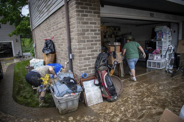
The Pittsburgh region won’t have much time to recover from weekend flooding, as more storms are expected to roll in Monday evening, meteorologists said.
Mike Kennedy, a meteorologist with the National Weather Service in Moon, said residents can expect continued thunderstorms to begin Monday around 6 p.m. and to continue until midnight.
Monday morning calls for partially sunny weather along with patchy fog. Then, later in the afternoon, the weather will be mostly cloudy with a 90% chance of showers.
Along with the thunderstorms, there could be tornado warnings and hail. Temperatures are expected to be between 78 to 80 degrees, Kennedy said.
While chances of a tornado are on the lower end, residents should still expect high winds between 60 to 70 miles per hour, he said.
“Severe criteria officially is 58 miles an hour,” Kennedy said, so today’s winds are not abnormal for a severe storm during this time of year.
According to the National Weather Service daily forecast, on Tuesday there is a 70% chance of rain with partly cloudy conditions and highs in the mid 70s.
Kennedy said he expects the weather to clear up a little during the midway point of this week.
“After we get through this today, Tuesday, Wednesday, Thursday, for sure will be dry, and then we’ll start to see increasing chances for our typical summer showers and thunderstorms Friday and definitely into the weekend,” he said.