With the threat of Hurricane Erin growing, a state of emergency was issued Sunday in portions of the Outer Banks, prompting evacuations.
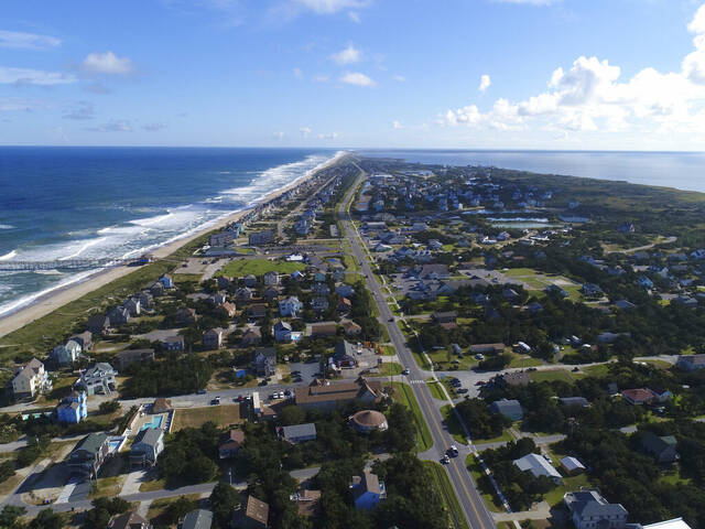
The Outer Banks is a popular summer vacation hub in North Carolina for many families in Western Pennsylvania.
The state of emergency includes all of Dare County, North Carolina, which is where a Coastal Flood Watch had already been issued, according to the county’s website.
Dare County includes the following municipalities:
- Duck
- Southern Shores
- Kitty Hawk
- Kill Devil Hills
- Nags Head
- Manteo
A mandatory evacuation order was issued for Hatteras Island as well. This includes the unincorporated villages of Rodanthe, Waves, Salvo, Avon, Buxton, Frisco and Hatteras — which all fall in Hurricane Evacuation Zone A.
All visitors must evacuate Hatteras Island beginning at 10 a.m. Monday, and all residents must evacuate beginning at 8 a.m. Tuesday, Dare County announced.
“Now is the time to make final preparations, secure property, evacuate with all personal belongings and follow instructions from your property management company,” the announcement said.
8/18 5pm EDT: Coastal flooding is possible from Hurricane #Erin along the Outer Banks of North Carolina beginning late Wednesday, where a Storm Surge Watch has been issued. pic.twitter.com/IXavdhIYUH
— NHC Storm Surge (@NHC_Surge) August 18, 2025
Coastal flooding is expected to begin as early as Tuesday and continue through Thursday, Dare County officials said. This will result in portions of N.C. Highway 12 on Hatteras Island likely being impassable for several days.
Though the center of the storm is forecast to stay at least 200 miles from the Outer Banks and Hurricane Erin isn’t expected to directly hit the East Coast, it will bring riptides all along the East Coast, officials said, according to the Weather Channel and the Associated Press.
Erin is the first Atlantic hurricane of 2025, and it reached an exceedingly dangerous Category 5 status Saturday with maximum winds of 160 mph before weakening. Its maximum sustained winds were 125 mph Sunday afternoon, according to the National Hurricane Center in Miami.
Those who are evacuating should travel westbound on Highway 64 to Interstate 95, as evacuating through the rural areas will help avoid traffic backups and congestion that may prolong evacuation, The Outer Banks Voice reported.
Evacuations are only called when people’s lives and safety are at risk, according to Dare County.
“Everyone should therefore heed evacuation orders at the time that they are issued,” the announcement says. “Should you ignore an evacuation order, you may be in serious danger due to the effects of the storm — and waiting too late to evacuate could put you in even greater danger.”