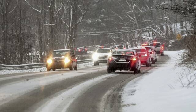
Parts of Western Pennsylvania, including the Pittsburgh metro area, are under a winter storm watch that could deliver 3 inches or more of snow and sleet beginning early Thursday.
The National Weather Service in Moon has issued the advisory for a period from 1 a.m. Thursday until 10 a.m. Friday.
The watch includes Allegheny, Washington, Beaver, Butler and Lawrence counties. Heavier snow accumulations — up to 6 inches — are possible for areas north of Interstate 80, with lighter accumulation expected elsewhere.
Ice accumulation of about a quarter inch is possible across most of the affected area, creating a potential for hazardous driving conditions, power outages and tree damage.
The upcoming winter storm will begin as rain for most locations, with a changeover to freezing rain, sleet, & eventually snow as colder air filters in. Below is an explanation & a timeline of when you can expect freezing rain impacts to begin, & when snow will eventually end. pic.twitter.com/Z4yaXdLolk
— NWS Pittsburgh (@NWSPittsburgh) February 1, 2022
A Winter Storm Watch has been issued for east-central Ohio, the northern WV panhandle, and portions of western PA for a system affecting the area Wednesday Night through early Friday. pic.twitter.com/5O9zyIVA8O
— NWS Pittsburgh (@NWSPittsburgh) February 1, 2022