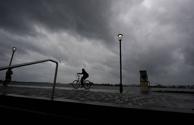
After wreaking havoc on Louisiana, the remnants of Hurricane Ida will travel toward Western Pennsylvania, bringing rain and potential flooding Tuesday and Wednesday.
Ida, which became a tropical storm as it slowed over Mississippi on Monday morning, caused widespread damage and power outages in Louisiana before moving north.
The storm is expected to reach the region by Tuesday, said Lee Hendricks, a meteorologist with the National Weather Service.
Showers and thunderstorms were expected throughout the day and into the night Monday, he said, before Ida’s remnants bring heavy rainfall Tuesday.
Follow Ida’s path
National Hurricane Center’s cone of probable path
Accuweather’s cone of probable path
A flash flood watch will be in effect for the entire region from Tuesday night into early Thursday.
Pittsburgh and the southern section of Allegheny County are expected to get 2 to 3 inches of rain, while the area north of Pittsburgh likely will get 1.5 to 2 inches.
The Greensburg-Latrobe area and northern Westmoreland County are predicted to recieve 2 to 3 inches of rain, while the mountains in the Ligonier area and eastern end of the county are expected to see 3 to 4 inches of rain. Fayette also is in the 3- to 4-inch range, according to NWS rainfall predictions as of Monday afternoon.
Some areas could see up to 6 inches of rain between Tuesday and Wednesday, Hendricks said.
Heavy rainfall associated with the remnants of Hurricane Ida is expected Tuesday night into Wednesday. As a result, a flash flood watch has been issued for the area most likely to receive the highest rain. Amounts of 2 to 4 inches are expected, with locally higher amounts. pic.twitter.com/ucC0bV7jnk
— NWS Pittsburgh (@NWSPittsburgh) August 30, 2021
“If it was snow, you would have anywhere from 7 inches of snow up to 20 inches,” he said.
The heavy rain could cause some minor flooding, but major flooding — so far — seems unlikely, Hendricks said.
“All the rivers in the region will rise in response to the rain, but thankfully right now our rivers are all at a relatively low level,” he said.
Smaller streams, however, may flood — and there will be enough rain to warrant extra caution while driving, Hendricks said. He encouraged people to be aware of the weather, particularly at night when it may be difficult to see exactly how much water might be on the roads.
PennDOT also urged caution, issuing a reminder Monday for drivers to avoid flooded streets.
“The Pennsylvania Department of Transportation cautions motorists to never drive through flooded roadways, as it takes just 2 feet of fast-moving water to float a car,” PennDOT said.
People who drive around barriers closing roads can face increased penalties if emergency responders are called to rescue those who disregarding traffic control signs, officials said.
Pittsburgh’s Public Safety crews were preparing for the storm, said Public Safety Director Wendell Hissrich. Over the past two weeks, the city’s flood gates were serviced, he said. Public Safety teamed up with the Department of Public Works to ensure drains were clear ahead of the rain.
They prepared a schedule for Swift Water Flood Response Units, specialized teams made of police, fire and EMS personnel, who likely will be pre-positioned “in different parts of the city where it’s known to flood,” Hissrich said.
He urged people to exercise caution while driving and to prepare for the storm by keeping flashlights on hand in case of power outages and clearing rain spouts.
Pedestrians, too, should be careful to avoid rushing water, he said.
“This is not the time to have your children near creeks or flowing water where they could get washed away,” Hissrich said.
Anyone who encounters flooded streets or downed power lines should call 911, he said, adding that public safety teams will monitor downed power lines until electric companies arrive.
“Like everything else, our job is to keep the public safe,” he said, explaining that emergency crews will be equipped with flotation devices and rope to help those stuck in rising waters.
Westmoreland preps for storm
In Westmoreland County, officials are making similar preparations, Public Safety Director Roland “Bud” Mertz said. They’ve reached out to local emergency management coordinators, fire chiefs, police chiefs, EMS directors, Red Cross and experts in everything from human services to health care to ensure there’s a coordinated effort to tackle whatever challenges the impending storms may bring.
The county’s Swift Water Rescue crews will be on standby, Mertz said. Emergency responders are ready to work around the clock.
“As the event escalates, they’ll be monitoring, and we’ll put them on standby as needed when we start getting certain criteria from the National Weather Service,” he said.
Allegheny County Emergency Services similarly worked to communicate up-to-date information with municipal coordinators before the storm, said Chief Fire Marshal Matthew Brown.
“We have recommended to them that they inspect and prepare equipment and revisit tasks like cleaning stormwater drains,” he said, adding that they’re also working with the National Weather Service.
Allegheny County Department of Public Works crews will be on-call 24 hours a day, said Public Works Director Stephen G. Shanley.
While local officials and first responders are preparing, the public also should be making plans in advance to deal with emergency scenarios, Mertz said.
“A lot of it has to do with people being alert, being aware, being prepared,” he said. “The event is going to cover a large area. An awful lot of first responder equipment and teams are going to be activated and in use, so they need to make decisions before they are in harm’s way and not when it’s too late. You don’t want to start writing plans when you’re in water up to your ankles.”
He encouraged people who live in areas that typically flood to make necessary preparations for evacuation before flooding starts, and urged drivers to be ready to turn around if they come upon flooded roads.
Westmoreland County residents also can stay up-to-date on the situation as it unfolds by signing up for Code Red, the county’s mass notification system, which can send emergency notifications to cellphones, through emails or via calls to a landline.
The rains will come to an end “fairly abruptly” Wednesday night, Hendricks said.
“By Thursday, we’re looking at sunny skies and a high in the mid-70s,” he said. “The holiday weekend is looking pretty good.”
Labor Day weekend should be dry, with temperatures ranging from mid-to-upper-70s before approaching 80 degrees Sunday.


