

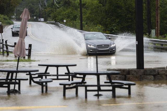


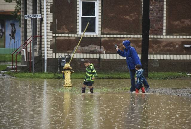
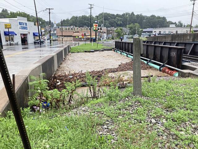


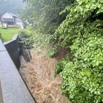

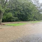


Heavy rains thrashed Pennsylvania on Wednesday as the remnants of Hurricane Ida churned across the area, dropping several inches of rain and causing flood damage across parts of the region.
By about 9 p.m., 2.3 inches of rain had fallen at the National Weather Service’s Pittsburgh office in Moon, according to the agency. Over the past two days, that total is 3.3 inches.
Shortly after 5 p.m. on Wednesday, the U.S. Army Corps of Engineers declared a state of emergency related to flood conditions along the Monongahela River.
The declaration authorizes the Corps to undertake support emergency response activities caused by the natural disaster.
In Westmoreland County, National Weather Service meteorologists said reports out of Latrobe showed just over 2 1/2 inches of rain over the past 24 hours, with the highest report, 4.42 inches, coming from the Seward area along the banks of the Conemaugh River.
A flash flood warning initially set to expire by early afternoon was extended until 3:30 p.m. for some areas of Allegheny, Fayette, Washington and Westmoreland counties. Municipalities covered include Jefferson Hills, Greensburg, Mt. Pleasant, Connellsville, Uniontown and Ligonier.
2.25 inches of rain fell since 8am yesterday at our office in Moon, PA.
— NWS Pittsburgh (@NWSPittsburgh) September 1, 2021
State meteorologist Jeff Jumper said the state is under a level four high-risk flash flood threat – the highest category there is.
“Imagine about a month to two months worth of rain falling in less than 24 hours,” Jumper said.
He said the state rarely sees such high-level flood threats, and a level four warning has only been issued 13 times since 2010.
Flash Flood Warning including West Mifflin PA, McKeesport PA, Greensburg PA until 3:30 PM EDT pic.twitter.com/BmZFGLw9Yu
— NWS Pittsburgh (@NWSPittsburgh) September 1, 2021
A body was found in the Allegheny River in Plum shortly after 10 a.m., according to Allegheny County Police. It was not immediately clear if the man, who police did not identify, might have died amid the floodwaters.
Homicide detectives are investigating, and no further information was immediately available.
In Cambria County, authorities evacuated Wilmore Borough, a small municipality about 14 miles northeast of Johnstown, because the Wilmore Dam had reached capacity and “could fail,” according to officials.
Authorities said firemen were going door-to-door in the community of 240 residents and asking people to gather at the St. Bartholemew Church Hall Wednesday afternoon, according to a social media report by the neighboring Franklin Borough Volunteer Fire Department.
Residents were back in their homes around 8 p.m. Wednesday evening, however, according to a Cambria County 911 supervisor.
Although the flood waters have breached the dam along the Conemaugh River outside Wilmore, “the dam has not failed,” said Lauren Fraley, a Department of Environmental Protection spokeswoman in Pittsburgh.
DEP representatives are in contact with the state’s Bureau of Dam Safety and are monitoring the situation, Fraley said.
Late Wednesday afternoon, the dam was continuing to perform as intended — water was flowing into the emergency spillway, which helps to prevent further degradation of the structure, said Pennsylvania Emergency Management Agency communications director Ruth Miller.
In Scott, the board president and vice president declared a state of emergency in the township shortly after noon, according to Allegheny County officials.
The President and Vice President of the Board in Scott Township have declared a state of emergency.
— Allegheny County (@Allegheny_Co) September 1, 2021
Allegheny County Executive Rich Fitzgerald said that in addition to Scott, the municipalities of Bridgeville and Millvale have declared emergencies. He said Oakdale officials have said they are declaring an emergency but the paperwork has not yet been submitted.
Matt Brown, chief of emergency services for Allegheny County, said the river crests are dropping – good news, he said, as authorities had been particularly concerned about flooding on the Mon and the Yough.
While rainfall is slowing, he said, “the damage is already done.
“The rivers, the creeks and the streams are still rising, and they’re rising rapidly,” Brown said.
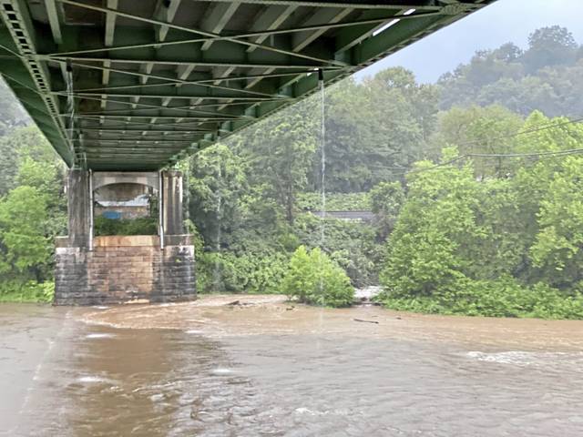
According to the National Weather Service, by 9:30 p.m. Wednesday, area rivers were running slightly lower than expected. At the time, the Conemaugh River at Seward was the only area to reach moderate flooding at 7 p.m. Wednesday when water levels peaked at about 14 feet. Flood stage in that area is reached at 12 feet.
By 7 a.m. Thursday, water levels were receding.
Three other areas — the Youghiogheny River at Sutersville and Connellsville and the Monongahela River at the Elizabeth Lock — appeared to have escaped major flooding Thursday morning. At Sutersville, the river is expected to crest at 14 feet around 2 p.m. Flood stage at that location is 20 feet.
In Connellsville, the Yough is crested just under 10 feet and started to recede. Flood stage is 12 feet.
The Mon at the Elizabeth Lock hit 16.37 feet before water levels started to drop. Flood stage is 20 feet.
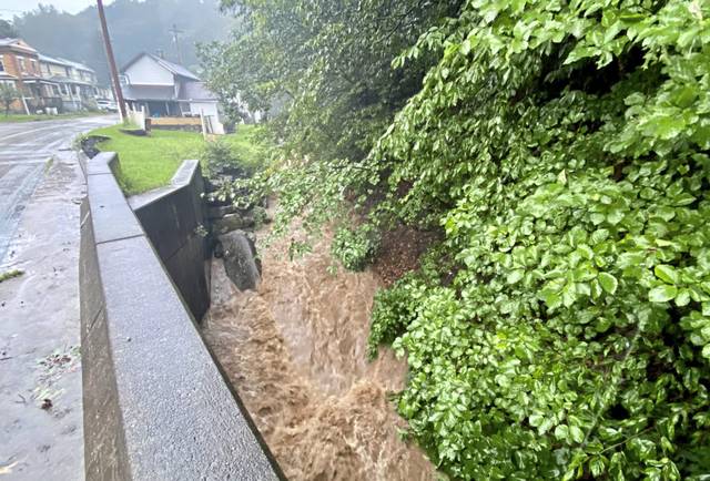
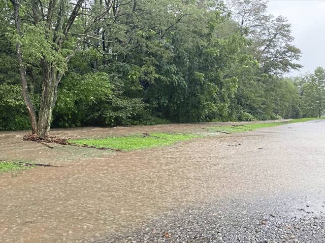
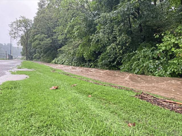
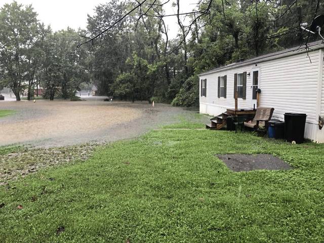
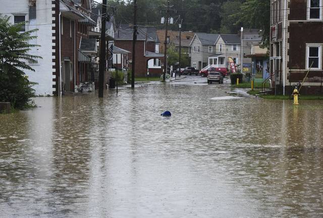
By mid-morning Wednesday, some areas had seen more than a half a foot of rain, and creeks and streams were flooding in Etna, Bridgeville, South Park, Finleyville and more.
New Kensington-Arnold administrators decided around 8 a.m. to send students home from Valley High School as water was rising in Little Pucketa Creek in front of the school. Buses were arriving to take students home around 9 a.m., while those who drove went to their cars.
Assistant Superintendent Jon Banko said students arrived between 7 and 7:15 a.m., after which the creek rose about two feet in about 20 minutes, and was beginning to encroach on the parking lot across the creek from the school.
“It’s up now. It wasn’t in the parking lot this morning,” Banko said.
Administrators were also being sent home, so they do not get stranded. There was concern that debris could dam up at the bridges.
“What we don’t want is people stuck on the other side,” Banko said.
He did not know if students would have to make up the day.
How things look upstream of Valley High School at Memorial Park. pic.twitter.com/133BRUmf8t
— Brian Rittmeyer (@BCRittmeyer) September 1, 2021
The adjacent Northern Westmoreland Career & Technical Center also sent students home, with all out by around 9:30 a.m. Teachers stayed in the building and students will work remotely. The school serves about 460 students from New Kensington-Arnold, Burrell, Kiski Area, and Franklin-Regional.
Ligonier Valley School District also issued early dismissals Wednesday, officials announced.
Other school districts across the region canceled classes. Canon-McMillan and West Jefferson Hills closed, officials announced Wednesday morning. Officials at Baldwin-Whitehall also decided to close Wednesday, pushing back the first day of school until Thursday, according to a post on their Facebook page.
Check a list of area school closings and delays from WPXI.
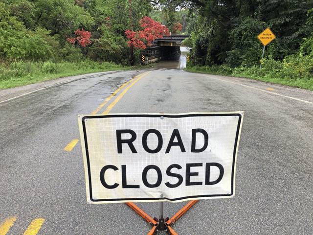
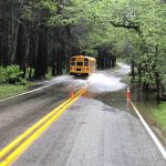
Shaler Area School District closed primary and elementary schools Wednesday morning after flood waters trapped a bus transporting students. According to Shaler police, all students who were on the bus were evacuated to a safe area. The road remains closed between Soose Road and Elbe Drive.
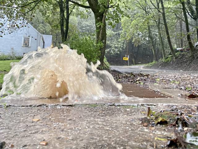
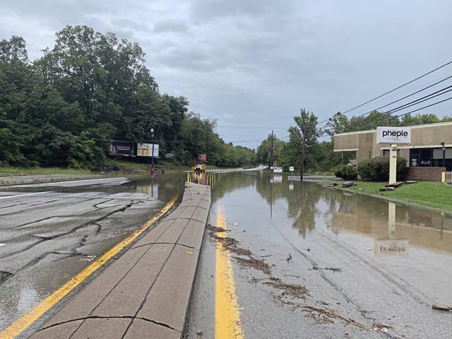
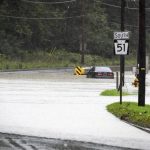
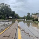
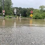
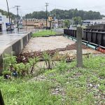
Several other roads across the region also began flooding Wednesday morning as rain continued to move through the region.
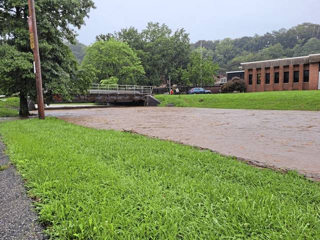
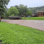
In Greensburg, Lynch Field Park continued to fill with flood waters Wednesday morning. The field, a natural bowl surrounded by asphalt walking paths, often floods, causing the city to pump the water into Jacks Run. By Wednesday, water flowed onto a parking lot, surrounding the Greensburg Volunteer Fire Department’s drill tower.
Part of Lynch Field Park in Greensburg remains flooded as remnants of Hurricane Ida move across Western Pennsylvania. pic.twitter.com/SZXEvcM3kr
— Megan Tomasic (@MeganTomasic) September 1, 2021
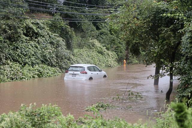
Flooding, along with downed trees and wires, closed several Allegheny County roads Wednesday morning.
According to PennDOT, closed roads as of 5 p.m. include:
- Kittanning Pike in O’Hara, from Mary Street to the Sharpsburg borough line.
- Plum Street in Oakmont, between Sixth Street and Dark Hollow Road.
- Geyer Road in Reserve, between Mt. Troy Road and Babcock Boulevard in Shaler.
- Snowden Road in South Park is reduced to a single lane due to debris on the road.
- McLaughlin Run Road, between Bower Hill Road in Bridgeville and Route 19 in Upper St. Clair.
As Ida continued to move across the region, area residents expressed concerns about the possibility of more flooding throughout the day.
Gilpin resident Frank Simon, 70, has lived next to Brady’s Run Creek for more than 40 years.
He was outside Wednesday morning monitoring the creek levels.
“I’m concerned it could go over the banks,” Simon said. “I get up earlier than normal and make sure things aren’t getting out of hand.“
Surveying the rapid waters, Simon said he estimated the normally calm and shallow creek to be at more than three-feet deep.
“You’d be in big trouble,” said Simon, referring to the safety concern if someone fell into Brady’s Run under the current conditions caused by Ida. “That is really fast. You’d probably never be able to get your footing.”
In addition to flooding, downed trees and wires are causing power outages across the region. According to West Penn Power, nearly 21,770 customers were impacted by power outages as of 4:30 a.m. Thursday. At that time, Duquesne Light did not have any current outages, according to an outage map.
Ida made landfall along the Gulf Coast early Sunday as a Category 4 hurricane with winds reaching 150 mph. After devastating parts of Louisiana, the system became a tropical storm as it began a northward journey Monday. As Ida reached the border of Kentucky and West Virginia, it was again downgraded to a tropical depression.
According to NWS Meteorologist Rich Redmond, Ida was originally expected to dump heavy rain throughout the region Tuesday night into Wednesday morning. NWS Meteorologist Bill Modzlewski told the Tribune-Review Tuesday night that the leading edge of the system was expected to cross into Pennsylvania between 2 and 3 a.m.
However, drier air that moved into the area from the south through West Virginia “hindered heavier rain from developing,” Redmond said.
Overnight, the region saw between a quarter to three-quarters of an inch of rain, he said.
Still, as the system continued moved across Western Pennsylvania Wednesday, rain totals were expected to reach between 3 and 4 inches in Westmoreland, Fayette and Indiana counties, according to the National Weather Service of Pittsburgh’s Twitter. Between 2 and 3 inches was expected in Allegheny and Washington counties.
As predictions stood Wednesday morning, several river points in Allegheny and Westmoreland counties were expected to flood in the coming days.
According to Redmond, the Monongahela River at Charleroi was expected to crest at a major flood stage by 8 a.m. Thursday and the Monongahela River at Braddock expected to reach a possible major flood stage at 2 p.m Thursday. By Thursday morning, no flooding was predicted for those locations.
In addition, the Point in Downtown Pittsburgh was expected to see minor flooding. According to officials with the Army Corps of Engineers Pittsburgh district, that high-water event could also cause the Monongahela Wharf, 10th Street bypass and the Parkway “bathtub” to be out of service from Wednesday through Friday afternoon.
Little Plum Creek is raging through Plum and starting to overflow it’s banks in spots near the baseball fields. @TribLIVE @PlumAdvancePGH pic.twitter.com/8zTrcFh6Cs
— Rob Amen (@RobAmenTrib) September 1, 2021
“These are all based on forecasted rainfall amounts,” Redmond said. “We still kept the river flood watch up instead of going for warnings yet because we’re not seeing the rainfall amounts that we were expecting and so those numbers will likely be adjusted today as the data starts to come in with how much rain has actually fallen.”
River flooding forecasts will likely be updated Wednesday morning.
Water creeping onto the Mon Wharf… it’s closed today… #Ida pic.twitter.com/06Hik2nKUj
— JoAnne Harrop (@joannescoop) September 1, 2021
As the result of rising river water, the Army Corps of Engineers Wednesday expected the Braddock, Charleroi, Elizabeth, Grays Landing, Maxwell and Point Marion locks and dams along the lower Monongahela River to be temporarily out of service until water levels recede. The Hildebrand, Morgantown and Opekiska locks and dams will remain in service.
To help mitigate potential flooding in Pittsburgh and surrounding communities, the Corps performed controlled releases at the Conemaugh, Stonewall Jackson, Tygart and Youghiogheny reservoirs Wednesday. The goal was to retain water and reduce downstream water levels.
Additionally, the non-closed portion of Washington Boulevard (south of the flood gates) is also starting to pond pic.twitter.com/IJE9A1EwDw
— Megan Guza (@meganguzaTrib) September 1, 2021
Gov. Tom Wolf signed a proclamation of disaster emergency ahead of the storms, which allowed state agencies to pre-position resources and activate the National Guard to respond if necessary. About 120 Pennsylvania guard members are activated, including some within the Pennsylvania Helicopter Aquatic Rescue Team.
The Commonwealth Response Coordination Center began its 24-hour operations at 8 a.m. PennDOT crews spent the lead-up to the heavy rains clearing debris from drainage inlets and under bridges, officials said.
Randy Padfield, director of the Pennsylvania Emergency Management Agency, said his agency has sent water rescue teams from areas seeing less flooding to those hit harder.
Wolf urged residents to stay home if they’re able.
“This is an extremely dangerous storm that is impacting the entire state,” he said. “As we continue to monitor the conditions, I ask everyone to please stay home if you’re able.”
The state Department of Conservation and Natural Resources shut down campsites Wednesday and Thursday in numerous state parks and forests as the rain moved through. Those closures affect Kooser, Linn Run and Laurel Hill parks, among several others statewide. Visitors were asked to leave by noon Wednesday.
In addition, the Pennsylvania Fish and Boat Commission warned boaters of high water conditions over Labor Day weekend.
“While the heavy rains have passed and the sun may be shining, high and muddy water conditions will remain on many rivers, creeks, and streams for several days and well into the Labor Day holiday weekend,” Laurel Anders, director of the PFBC Bureau of Boating, said in a news release.
Boaters are advised to refrain from entering high, fast-moving and muddy water. Those conditions can cause low visibility that could prevent boat operators from seeing submerged debris like rocks and downed tree limbs. Caution was also urged for those walking along streambanks that could be muddy and slippery.
Smithton and West Newton appeared to have avoided any major impact from the heavy rains. But Smithton firefighters are keeping an eye on neighboring communities Jacob’s Creek and Connellsville. Assistant Fire Chief Nick Frohnhofer said if the Youghiogheny River floods in Connellsville, Smithton likely will be next.
“The river’s going to be our problem,” said Chief Joel Ribniscky.
They expected flooding to happen Thursday morning if the river gets high enough.
Prior to Ida reaching Pennsylvania, local officials in Western Pennsylvania began preparing for significant rainfall and potential flooding.
Ida is expected to move out of the region Wednesday evening.