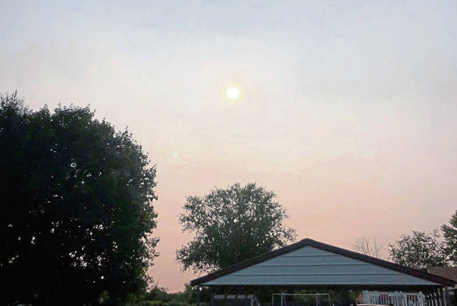
The first plumes of smoke from the massive wildfires burning on the West Coast began reaching Pittsburgh on Aug. 25, according to the National Oceanographic and Atmospheric Administration.
But Tuesday was the day people began to notice, as the massive smoke plume from some of California’s largest-ever wildfires, along with blazes in Oregon and Washington, gave the Pittsburgh region a hazy look high in the sky.
“This smoke rises and gets caught in the upper level winds, which this time of year are mostly out of the West,” said Bill Modzelewski, a meteorologist with the National Weather Service in Moon Township. “It transports that smoke across the area, between 25,000 and 30,000 feet off the ground.”
This year’s has been the most intense California fire season in nearly two decades, according to NOAA’s Office of Satellite and Product Operations. Although East Coast residents are seeing the plume in the sky, it has little effect on the air they breathe.
“With it being so far above the surface, there’s really no effect on air quality,” Modzelewski said.
It does, however, filter out sunlight, “and it can cause temperatures to be a little cooler than they otherwise would,” he added. “We saw that Monday and (Tuesday), too.”