Old-timers in the Alle-Kiski Valley might have heard stories of a cave high above the riverbank in Lower Burrell that was used as a lookout post by Native Americans in their war against settlers and later as a vantage point to spy on the Orr’s Blockhouse at the mouth of Bull Creek.
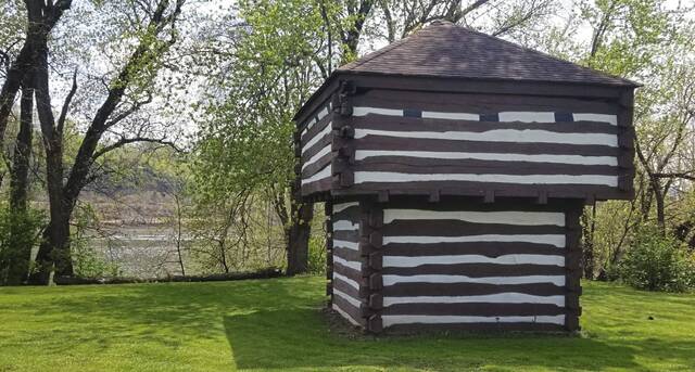
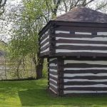
The blockhouse was constructed in 1783 by Capt. Robert Orr to help protect travelers, scouts and fur traders passing through the area. In 1985, a replica of the blockhouse was constructed near the Tarentum Boat Ramp to spotlight the borough’s history.
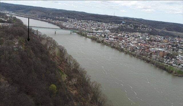
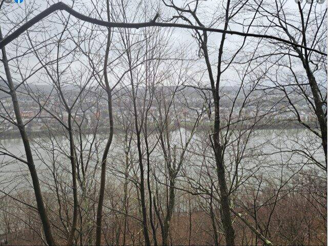
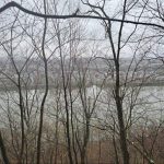
The Alle-Kiski Valley Historical Society archives contain old newspaper clippings that mention the cave near the top of the hill across the Allegheny River from Tarentum’s Corbet Street.
More recent accounts describe the cave as being close to the top of the cliff face, near the end of Michigan Avenue in Lower Burrell.
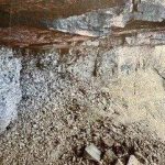
People who have visited the cave say it is cut into the shale face of the hill and has soot on its ceiling that appears to be from ancient campfires.
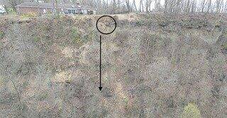
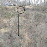
Efforts to locate the cave with a telescope set up in Tarentum’s Riverview Memorial Park were unsuccessful because of excessive glare on the hill. So William Thiele, a drone pilot from the Cabot section of Winfield, was contacted to aid in the search.
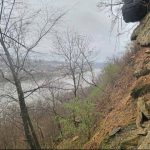
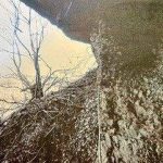
In April 2022, he spent several hours operating his drone from Riverview Memorial Park. He photographed the cliff face and the view from the approximate area of the cave.
Despite capturing detailed photos, no opening in the cliff face that matched previous descriptions was found.
Copies of the drone’s photos were uploaded to several Tarentum and Lower Burrell Facebook groups asking anyone who had visited the cave to mark its location on the photographs.
Most of those who responded described the cave as triangular with a stone column supporting a stone overhang. That type of description would be classified by archaeologists as a rock shelter rather than a cave.
All of the replies identified the same area near the top of the cliff at the end of Michigan Avenue in Lower Burrell.
A woman responded who owned the house at the end of Michigan Avenue and the land on which the cave was said to be located. She said that approximately 15 years ago, after a heavy rain, part of the rock overhang and the support column had given way and slid down the face of the hill toward the river. It was this event that was making it so difficult to identify the location of the cave in photographs.
Her brothers had visited the cave on numerous occasions and took photos, she said.
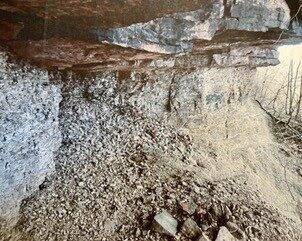
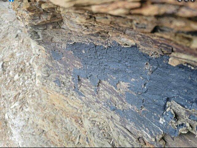
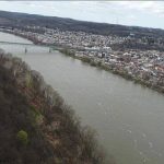
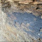
Mark Drum of Tarentum, who was intrigued by the search for the cave, decided to climb down the cliff face to see it for himself. He captured images of the cave’s inside walls and views of the Allegheny River and Tarentum from the cave’s opening.
An interesting detail in some of Drum’s photographs is what appears to be a thick black paintlike coating on part of one wall. The material is beginning to peel away from the rock face because of exposure to the elements.
If this material was left by Native Americans, it would be considered a very rare and important discovery. Archaeologists have been invited to visit the site, but so far none have visited.
People who have visited the cave site in recent years have strongly cautioned against others climbing down to view it. The overhanging rocks and poor footing have made it an extremely dangerous place to visit.