


In some ways, it was the Florida Man of storms — not quite knowing when to say when.
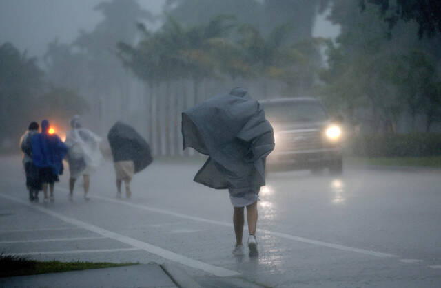
Usually, thunderstorms fizzle out after they run out of rain or get cold air sucked in. But not Wednesday, when the storm that hit Fort Lauderdale had the warm and moisture-rich Gulf Stream nearby.
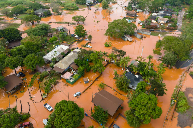
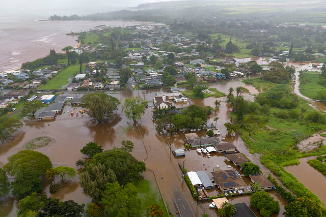
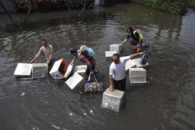
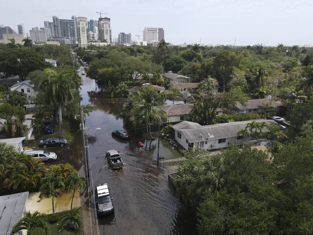
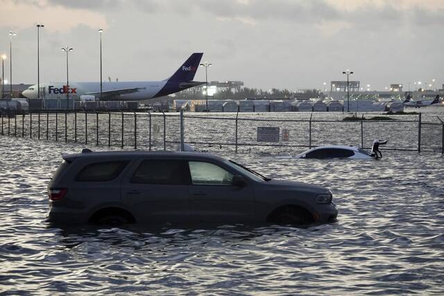
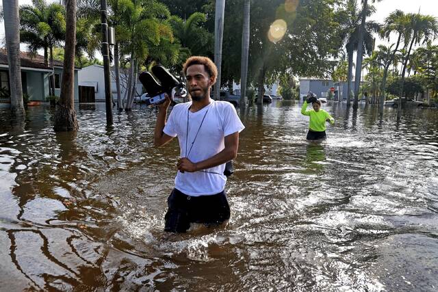
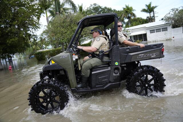
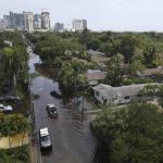
The end result was more than 25 inches (63.5 centimeters) of rain drenching and flooding Fort Lauderdale in six to eight hours. That ranked among the top three in major U.S. cities over a 24-hour period, behind Hilo, Hawaii’s, 27 inches (68.58 centimeters) in 2000 and Port Arthur, Texas’s 26.5 inches (67.31 centimeters) in 2017, according to weather historian Chris Burt.
While it could happen in other places in coastal America, Florida has the right topography, plenty of warm water nearby and other favorable conditions, said Greg Carbin, forecast branch chief at the National Oceanic and Atmospheric Administration’s Weather Prediction Center.
Just two days before the downpour, Weather Prediction Center forecaster David Roth told colleagues that conditions were lining up similar to April 25, 1979, when 16 inches of rain (40.64 centimeters) fell on Fort Lauderdale, Carbin said.
What parked over Fort Lauderdale on Wednesday was a supercell — the type of strong thunderstorm that can spawn killer tornadoes and hail and plows across the Great Plains and Mid-South in a fierce, fast-moving but short path of destruction, several meteorologists said.
Normally a cell like that would “snuff itself out” in maybe 20 minutes or at least keep moving, Carbin said. But in Fort Lauderdale the supercell was in a lull between opposing weather systems, Carbin said. It lasted six to eight hours.
“You had this extreme warmth and moisture that was just feeding into the cell and because it had a bit of a spin to it, it was essentially acting like a vacuum and sucking all that moisture back up into the main core of the system,” said Steve Bowen, a meteorologist and chief science officer for GallagherRe, a global reinsurance broker. “It just kept reigniting itself, essentially.”
What was key, said former NOAA chief scientist Ryan Maue, was “the availability of warm ocean air from the Gulf Stream was essentially infinite.”
Other factors included a strong low pressure system, with counterclockwise winds, churning away in the toasty Gulf of Mexico, Maue and Carbin said. There was a temperature difference between the slightly cooler land in Florida and the 80-degree-plus Gulf Stream waters. Add to that wind shear, which is when winds are flowing in opposite directions at high and low altitude, helping to add some spin.
Many of those conditions by themselves are not unusual, including the location of the Gulf Stream. But when they combined in a precise way, it acted like a continuous feeding loop that poured rain in amounts that the National Weather Service in Miami called a 1-in-1,000 chance.
“We continue to see more and more of these thousand-year” weather extremes in major cities, Bowen said. “The whole definition of normal is changing.”
Physics states that a warmer climate holds more moisture in the air, about 4% more for every degree Fahrenheit (7% for every degree Celsius). But warming also increases the intensity of storms amplifying that moisture level, said University of Pennsylvania climate scientist Michael Mann.
And that moisture then falls as rain.
One-day downpours have “increased in frequency and magnitude over the last several decades and will continue to increase in both in the coming decades,” University of Oklahoma meteorology professor Jason Furtado said in an email. “These heavy rainfall events coupled with sea level rise on the Florida coast need to serve as significant ‘wake up calls’ for the residents of South Florida about the severe risks that climate change poses to them.”