


BAR HARBOR, Maine — Atlantic storm Lee — which made landfall at near-hurricane strength, bringing destructive winds and torrential rains to New England and Maritime Canada — kept weakening Sunday after officials withdrew some warnings and predicted the storm would disappear early this week.
The U.S. National Hurricane Center said Sunday morning that the post-tropical cyclone was about 70 miles (113 kilometers) west-northwest of Charlottetown, Prince Edward Island, and about 180 miles (290 kilometers) west of Channel-Port Aux Basques, Newfoundland. The top sustained wind speed had dropped to 45 mph (70 kph) with some higher gusts expected.
“Gradual weakening is forecast during the next couple of days, and Lee could dissipate on Tuesday,” the U.S. hurricane center said.
The sky was sunny in Maine on Sunday morning, where 5% of electricity customers were still without power, down from 11% by midday Saturday during the height of the storm. In Canada, 18% of Nova Scotia had no electricity, down from 27% on Saturday. The figure was 3% in New Brunswick, down from 8%, and less than 1% in Prince Edward Island, down from 3%.
The center discontinued a tropical storm warning for the coast of Maine late Saturday and reported the Canadian Hurricane Centre had ended its tropical storm warning for New Brunswick and parts of Prince Edward Island.
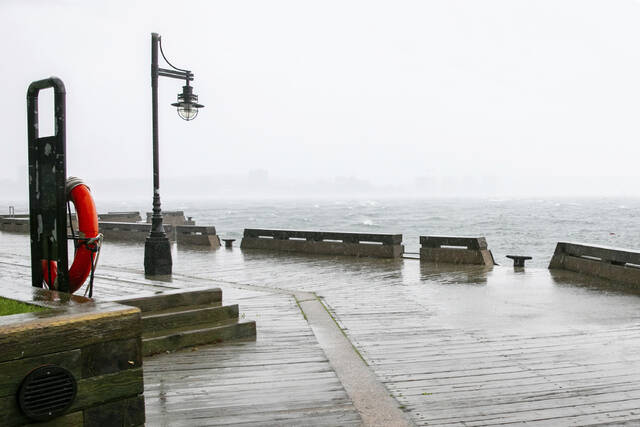
Storm surges were expected to subside on Sunday after being forecast as up to 3 feet (0.91 meters) on Saturday along coastal areas, the hurricane center said.
A 51-year-old motorist in Searsport, Maine, died Saturday after a large tree limb fell on his vehicle on U.S. Highway 1 during high winds. The limb brought down live power lines and utility workers had to cut power before removing the man, who died later at a hospital, Police Chief Brian Lunt said.
A driver suffered minor injuries Saturday, after a tree downed by Lee went through his windshield on Route 11 in Moro Plantation, Maine, according to Maine State Police. John Yoder, 23, of Apple Creek, Ohio, attempted to stop but couldn’t avoid the tree. Yoder suffered minor cuts but the other five passengers in the van were not injured. Police blamed high winds for the downed tree.
The storm was tracked as moving around 22 mph (35 kph) and expected to proceed northeast, taking the weather system across the Canadian Maritimes. Rainfall was expected to be an additional 1 inch (25 millimeters) or less for portions of eastern Maine, New Brunswick and Nova Scotia, the U.S. storm center said.
A tropical storm warning remained in effect for parts of Nova Scotia, the Magdalen Islands and Prince Edward Island with strong winds possibly leading to downed trees and power outages, the center said.
In Bar Harbor, Maine, the touristy gateway to Acadia National Park, a whale watch vessel broke free of its mooring and crashed ashore Saturday. Authorities worked to offload 1,800 gallons (6,813 liters) of diesel fuel to prevent it from spilling into the ocean.
Lee flooded coastal roads in Nova Scotia and took ferries out of service while fanning anxiety in a region still reeling from wildfires and severe flooding this summer. The province’s largest airport, Halifax Stanfield International, canceled all flights.
“People are exhausted,” said Pam Lovelace, a councilor in Halifax. “It’s so much in such a small time period.”
Hurricane-force winds extended as far as 140 miles (220 kilometers) from Lee’s center, with tropical storm-force winds extending as far as 320 miles (515 kilometers), enough to cover all of Maine and much of Maritime Canada.
The storm skirted some of the most waterlogged areas of Massachusetts that experienced severe flash flooding days earlier, when fast water washed out roads, caused sinkholes, damaged homes and flooded vehicles.
In eastern Maine, winds died down enough by late afternoon Saturday for utility workers to begin using bucket trucks to make repairs.
The entire region has experienced an especially wet summer, ranking second in the number of rainy days in Portland, Maine — and Lee’s high winds toppled trees stressed by the rain-soaked ground in Maine, the nation’s most heavily wooded state.
Cruise ships found refuge at berths in Portland, Maine, while lobstermen in Bar Harbor and elsewhere pulled traps from the water and hauled boats inland.
Billy Bob Faulkingham, House Republican leader of the Maine Legislature, and another lobsterman survived after their boat overturned while hauling traps ahead of the storm Friday, officials said.
The boat’s emergency locator beacon alerted authorities and the pair clung to the hull until help arrived, said Winter Harbor Police Chief Danny Mitchell. The 42-foot (12.8-meter) boat sank.
“They’re very lucky to be alive,” Mitchell said.
Lee shared some characteristics with 2012’s Superstorm Sandy. Both storms were once-strong hurricanes that became post-tropical cyclones — cyclonic storms that have lost most of their tropical characteristics — before landfall. But Sandy caused billions of dollars in damage and was blamed for dozens of deaths in New York and New Jersey.
Lee also was not anywhere near as severe as the remnants of Hurricane Fiona, which a year ago washed houses into the ocean in eastern Canada, knocked out power to most of two provinces and swept a woman into the sea.
Destructive hurricanes are relatively rare so far north. The Great New England Hurricane of 1938 brought gusts as high as 186 mph (300 kph) and sustained winds of 121 mph (195 kph) at Massachusetts’ Blue Hill Observatory. There have been no storms that powerful in recent years.
Separately, Tropical Storm Nigel was strengthening and expected to become a hurricane by Monday, the U.S. hurricane center said. It appeared to pose no threats to the U.S. or Canada. It was about 980 miles (1,575 kilometers) northeast of the Lesser Antilles and about 1,180 miles (1,895 kilometers) east-southeast of Bermuda. It had maximum sustained winds of 50 mph (85 kph) and was moving north-northwest at 14 mph (22 kph).