

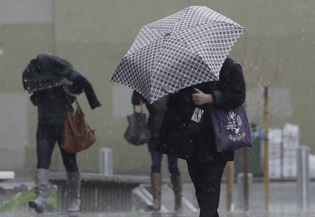


SAN FRANCISCO — Thousands of people in Northern California’s wine country were ordered to evacuate Tuesday evening shortly before a river reached flood stage as a winter storm dumped torrential rain and heavy snow that shut down major mountain highways.
Authorities said evacuations were ordered for about 4,000 people in and around Guerneville, which is about 60 miles north of San Francisco.
By 6 p.m., the river north of San Francisco — which is prone to flooding in heavy rain — had topped 32 feet and forecasters predicted it would peak at about 46 feet by Wednesday evening, which would be the highest level since 1995.
Additional Flooding as well as mud and rock slides in steeper terrain will continue tonight. The greatest threat area is highlighted in the graphic. #CAwx pic.twitter.com/ECNultFeLr
— NWS Sacramento (@NWSSacramento) February 27, 2019
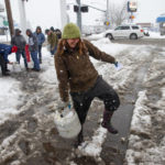
Earlier Tuesday at the River Inn Grill in Guerneville, workers were preparing by putting perishables on high shelves in storage rooms.
But manager Andre Vazquez said the one-story building could be largely submerged that if the river reaches 46 feet.
“If it gets to 46 feet, it’s done. There is no way to prepare for that,” Vazquez said.
Guerneville often floods during heavy rain and people seemed nonchalant Tuesday about the threat, said Joseph Chung, whose parents own the Koala’s Fine Food restaurant.
“A couple of weeks ago people were using kayaks to get to their mailbox,” Chung said. “If it gets really bad, we’ll get out.”
GOES-17 ?️ IR imagery (channel 15) shows the #AtmosphericRiver impacting north of the Golden Gate through the day. A sharp contrast in rain reports: 5+" of rain has been observed today in parts of the North Bay while Downtown San Francisco has only recorded 0.37". #CAwx pic.twitter.com/OlTJQJsa6e
— NWS Bay Area (@NWSBayArea) February 27, 2019
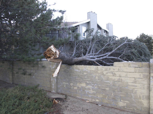
Earlier in the day, a mudslide near Monte Rio near Guerneville trapped a man and a woman before they were rescued, messy but unharmed.
“Well I fell into the mud when the tree fell over the top of me. It happened so fast you don’t even know, you know?” Kear Koch told KGO-TV.
The Napa River and some waterways in Mendocino County also were expected to top flood stages.
The National Weather Service also issued flood warnings and flash flood watches for the San Francisco Bay Area and many parts of the Sacramento area, lasting into Thursday morning.
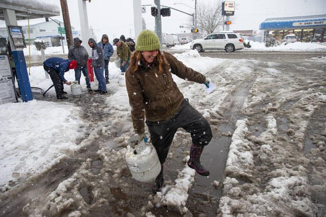
Relentless rain forced the cancelation or delay of hundreds of flights in San Francisco and the city of Santa Rosa received a record 5.66 inches of rain, making it the wettest day for the date since at least 1902.
Here’s more video from 80, this from Donner Summit about 20 minutes ago. 80 remains closed in both directions with no ETO. pic.twitter.com/IEyikWMLZf
— Caltrans District 3 (@CaltransDist3) February 27, 2019
In the Sierra Nevada, the California Department of Transportation reported that a maintenance yard above 6,000 feet had received 30 inches of snow along on Tuesday.
Several mountain and foothill roads were repeatedly closed because of whiteout conditions or to clear trucks and cars that spun out on the slippery pavement.
Interstate 80, a major road that winds over the Donner Summit, was to remain closed into Wednesday morning for about 50 miles, from Colfax to the Nevada state line, because of poor conditions and snow removal operations.
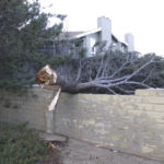
The storm also briefly left more than 20,000 customers without electricity in Northern California and Nevada.
The fierce weather was driven by a river of atmospheric moisture stretching from Hawaii. It already has barreled through other parts of the West, toppling trucks and trees, triggering power outages and closing roads and schools from Oregon to Montana.
It is the latest in a string that has dumped record levels of snow and rain this winter in the western United States.