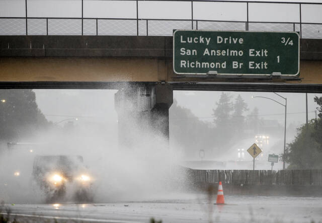
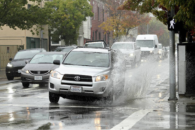


SAN FRANCISCO — A powerful storm roared ashore Sunday in Northern California, flooding highways, toppling trees and causing mud flows in areas burned bare by recent fires as forecasters predict record-breaking rainfall.
Drenching rain and strong wind accompanied the arrival of an atmospheric river — a long and wide plume of moisture pulled in from the Pacific Ocean that was predicted to move south over the next few days. The National Weather Service’s Sacramento office warned of “potentially historic rain.”
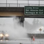
Flooding was reported across the San Francisco Bay Area, closing streets in Berkeley and inundating the Bay Bridge toll plaza in Oakland. By sunrise on Sunday, Mount Tamalpais just north of San Francisco had recorded over 6 inches of rainfall during the previous 12 hours, the weather service said on Twitter.
The second bomb cyclone is likely to travel farther south than the prior storms of this past week, bringing heavier precipitation and stronger winds to the West Coast. https://t.co/DKEJqoy73C pic.twitter.com/cxCfHvyJci
— AccuWeather (@accuweather) October 24, 2021
About 150 miles to the north, the California Highway Patrol closed State Route 70 in Butte County because of mudslides within the massive Caldor Fire burn scar.
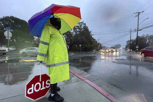
“We have already had several collisions this morning for vehicles hydroplaning, numerous trees falling, and several roadways that are experiencing flooding,” tweeted the highway patrol’s office in Oroville. “If you can stay home and off the roads today, please do. If you are out on the roads, please use extreme caution.”
Burn areas remain a concern, as land devoid of vegetation can’t soak up heavy rainfall as quickly, increasing the likelihood of mudslides and flash flooding that could trap people.
“If you are in the vicinity of a recent burn scar and haven’t already, prepare now for likely debris flows,” the Sacramento weather service tweeted. “If you are told to evacuate by local officials, or you feel threatened, do not hesitate to do so. If it is too late to evacuate, get to higher ground.”
An *incredible* atmospheric river event in #California.
— Matthew Cappucci (@MatthewCappucci) October 24, 2021
A "double bomb" off Pacific Northwest coast with an air pressure rivaling that of Sandy in 2012 is swirling ashore record moisture.
Up to a foot of rain, debris flows, meters of Sierra Nevada snow. https://t.co/oftY0AeAQM pic.twitter.com/cBH56EuqHF
South of San Francisco, evacuation orders were in effect in the Santa Cruz Mountains over concerns that several inches of rain could trigger debris flows in the CZU Lightning Complex Fire burn scar. Further south, parts of western Santa Barbara County were under an evacuation warning in the area burned by this month’s Alisal Fire.
Strong wind was also expected, with gusts of up to 60 mph at the windiest spots in Northern California. Elevations above 9,000 feet in the Sierra Nevada could get 18 inches of snow or more from Sunday until Monday morning.
Multiple creeks and streets flooding throughout Santa Rosa. Avoid unnecessary travel. | Múltiples arroyos y calles inundadas a través de Santa Rosa. Evite viajes innecesarios. https://t.co/xQ5ELqKU4A pic.twitter.com/5cKzmkmvZm
— Santa Rosa Fire Department (@SantaRosaFire) October 24, 2021
Recent storms have helped contain some of the nation’s largest wildfires this year. But it remains to be seen if the wet weather will make a dent in the drought that’s plaguing California and the western United States. California’s climate is hotter and drier now and that means the rain and snow that does fall is likely to evaporate or absorb into the soil.
California’s 2021 water year, which ended Sept. 30, was the second driest on record and last year’s was the fifth driest on record. Some of the state’s most important reservoirs are at record low levels.