

The oncoming storm couldn’t come at a worse time for Haitians struggling to deal with the effects of Saturday’s 7.2 magnitude earthquake, blamed for an estimated 1,300 deaths. Grace was expected to become a tropical storm again as it passes between Cuba and Jamaica on Tuesday and could be near hurricane strength when it approaches Mexico’s Yucatan peninsula Wednesday night. A tropical storm watch was in effect for the entire southern coast of Haiti, most of the southern coast of Cuba and the Cayman Islands. Fred’s main threats are rainfall and storm surge, the hurricane center said. Forecasters expected Fred to sustain 4 to 8 inches from Alabama across Florida’s Big Bend and Panhandle, and even a foot of rain in isolated spots, while the surge could push seawater of between 3 to 5 feet onto the coast between Florida’s Indian Pass and the Steinhatchee River.????TD Grace is near the southern tip of Hispaniola and is continuing to move WNW. The current forecast is showing it to move through the Gulf and into Mexico. However, it is still Hurricane season so please review your hurricane plans and monitor this page. ???? #lawx #mswx pic.twitter.com/AziAIxNYyP
— NWS New Orleans (@NWSNewOrleans) August 16, 2021
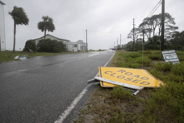
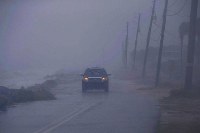
Forecasters warned that Fred also could dump heavy rain across and into the mid-Atlantic states, with flash floods as some rivers overflow and even landslides in the Blue Ridge mountains. Along Panama City Beach in Florida’s Panhandle, lifeguards have hoisted double-red flags, warning beachgoers against going into the Gulf of Mexico. The area braced for rain and some wind from the storm, and while no evacuations were ordered, schools and government offices were closed Monday. Shawna Wood, who is still rebuilding the waterfront Driftwood Inn in Mexico Beach after it was destroyed by Hurricane Michael, said the area was getting a lot of rain but conditions weren’t terrible.Apalachicola has seen storm surge observations over 4.7 feet, here is a look at that from earlier today in the area. #FLwx
Note: 6" of water can sweep a person off their feet, 12" can move a vehicle. This surge is over 55 inches. pic.twitter.com/jtt7gFmMqk — WeatherNation (@WeatherNation) August 17, 2021
On the Alabama coast, the city of Orange Beach offered sand and bags to residents worried about flooding. A half-dozen school systems shut down Monday, and a large church opened as a shelter. Salt water was washing over roads and causing flooding in low-lying areas of Dauphin Island, a coastal barrier south of Mobile, Alabama, at midday Monday, Mayor Jeff Collier said. Meanwhile, the season’s eighth tropical depression strengthened into Tropical Storm Henry on Monday near Bermuda, about 145 miles offshore. A tropical storm watch was in effect for the island as the system’s top winds grew to 40 mph.Heavy rainfall and the risk of flooding from #Fred is expected to spread inland over portions of the southeastern and eastern United States during the next couple of days. Follow the latest at https://t.co/tW4KeGdBFb pic.twitter.com/sexxw0d7pu
— National Hurricane Center (@NHC_Atlantic) August 16, 2021