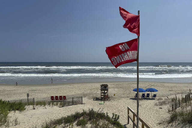


RODANTHE, N.C. — Hurricane Erin chugged slowly Tuesday toward the eastern U.S., stirring up treacherous waves that already have led to dozens of water rescues and shut down beaches along the coast in the midst of summer’s last hurrah.
While forecasters remain confident the center of the monster storm will remain far offshore, the outer edges are likely to bring damaging tropical-force wind, large swells and life-threatening rip currents into Friday.
Warnings about rip currents have been posted from Florida to the New England coast with New York City closing its beaches to swimming on Wednesday and Thursday. Several Long Island and New Jersey beaches also will be off-limits.
Our field correspondent Jonathan Petramala is on the ground as dangerous surf and powerful rip currents from #Erin pound the North Carolina coast with conditions expected to grow even more hazardous in the days ahead.
— WeatherNation (@WeatherNation) August 19, 2025
Stay tuned as we continue to update with the latest impacts… pic.twitter.com/uZJfswnYm1
“Enjoy the shore, enjoy this beautiful weather but stay out of the water,” New Jersey Gov. Phil Murphy said Tuesday.
Off Massachusetts, Nantucket Island could see waves of more than 10 feet later this week. But the biggest threat is along the barrier islands of North Carolina’s Outer Banks where evacuations have been ordered. One town asked residents to secure their trash cans so they don’t float or blow away.
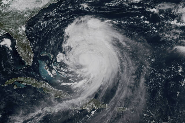
Erin has become an unusually large and deceptively worrisome storm while moving through the Caribbean, with its tropical storm winds stretching 230 miles from its core. Forecasters expect it will grow larger in size as it moves through the Atlantic and curls north.
It continued to lash the Turks and Caicos Islands on Tuesday, where government services were suspended a day earlier and residents were ordered to stay home, along with parts of the Bahamas before its expected turn toward Bermuda and the U.S.
By Tuesday, Erin had lost some strength from previous days and dropped to a Category 2 hurricane with maximum sustained winds of 105 mph, the National Hurricane Center in Miami said. It was about 615 miles south-southeast of North Carolina’s Cape Hatteras.
Hurricane Erin, now a Category 2 hurricane, has prompted a state of emergency in North Carolina and is expected to bring dangerous waves and rip currents to beaches along the East Coast.
— ABC News (@ABC) August 19, 2025
Follow along for live updates: https://t.co/dcNl5dMVd0 pic.twitter.com/bYTXt9LuX3
Tropical storm watches were issued for Virginia and North Carolina as well as Bermuda.
Rough ocean conditions already have been seen along the U.S. coast — at least 60 swimmers were rescued from rip currents Monday at Wrightsville Beach, near Wilmington, North Carolina.
The biggest swells along the East Coast are expected over the coming two days.
Climate scientists say Atlantic hurricanes are now much more likely to rapidly intensify into powerful and catastrophic storms fueled by warmer oceans. Two years ago, Hurricane Lee grew with surprising speed while barreling offshore through the Atlantic, unleashing violent storms and rip currents.
On the Outer Banks, Erin’s storm surge could swamp roads with waves of 15 feet. Mandatory evacuations were ordered on Hatteras and Ocracoke Islands. More than 1,800 people had left Ocracoke by ferry since Monday.
Storm surge warnings and tropical storm warnings have been issued in part of North Carolina, and conditions are starting to deteriorate as Erin lurks off the East Coast of the United States. pic.twitter.com/UGUnyHfXSm
— AccuWeather (@accuweather) August 19, 2025
North Carolina Gov. Josh Stein warned residents along the coast to be prepared in case they need to evacuate and declared a state of emergency on Tuesday. Bulldozers shored up the dunes, and on Hatteras, the owners of a pier removed a few planks, hoping the storm surge will pass through without tearing up the structure.
Most residents decided to stay even though memories are still fresh of Hurricane Dorian in 2019 when 7 feet of water swamped Ocracoke, said Randal Mathews, who serves as a county commissioner.
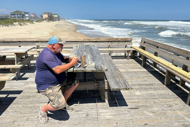
Tom Newsom, who run fishing charters on Hatteras, said he’s lived there almost 40 years and never evacuated, and wasn’t going to this time either.
Comparing this hurricane to others he has seen, he called this one a “nor’easter on steroids.”
Bryan Philips, who also lives on the island, said he’d evacuate if they were getting a direct hit. He expects the roads will be open by the weekend to make sure one of the last summer weekends isn’t lost.
“That’s their main concern: getting tourists back on the island as soon as possible,” said Philips.
Hurricane expert @DrRickKnabb times out when coastal flooding from Erin will be the worst along the East Coast. Watch: pic.twitter.com/e0FdO80X9b
— The Weather Channel (@weatherchannel) August 20, 2025
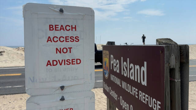
The Outer Banks’ thin stretch of low-lying barrier islands that jut into the Atlantic are increasingly vulnerable to storm surges. There are concerns that parts of the main highway could be washed out, leaving some routes impassible for days. And dozens of beach homes already worn down from chronic beach erosion and the loss of protective dunes could be at risk, said David Hallac, superintendent of the Cape Hatteras National Seashore.
Farther south, no evacuations had been ordered, but some beach access points were closed as forecasts call for water levels up to 3 feet over normal high tides for several days.