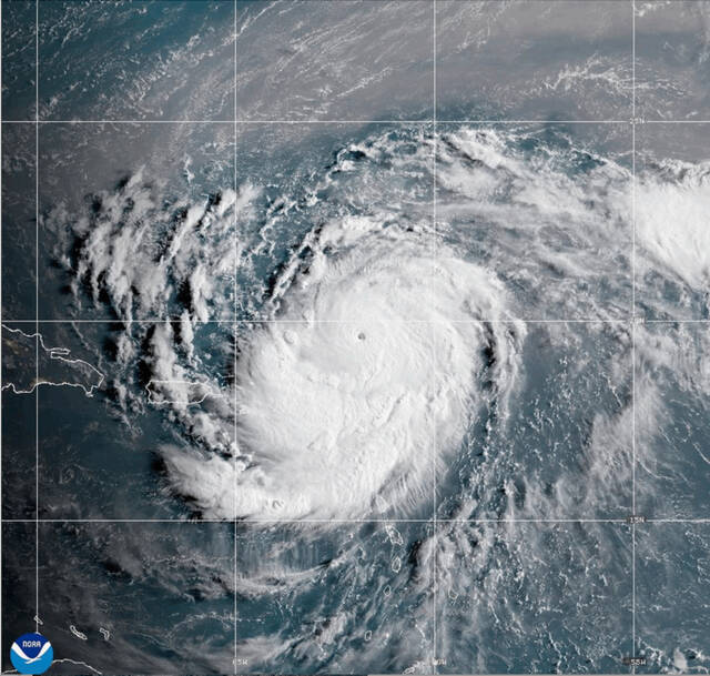


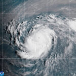

Hurricane Erin weakened to a Category 3 hurricane Sunday as its outer bands continued to lash the Virgin Islands and Puerto Rico with heavy rain and tropical-storm force wind.
While Erin’s maximum wind diminished, the storm’s overall size grew and forecasters issued tropical storm warnings for the Turks and Caicos Islands and a watch for the southeast Bahamas.
The storm wasn’t expected to directly impact the U.S. East Coast, but by doubling or tripling in size it could bring rip currents all along the coast. Gusty wind and flooding tides could wash out parts of the highway that connects the North Carolina Outer Banks by midweek, the National Weather Service said.
Hurricane #Erin's enormous wind field will also generate an expansive field of high ocean waves and swells that will radiate outward from the storm, extending farther than the strong wind field. This high surf and rip currents will create very dangerous beach conditions along… https://t.co/s5HX3Wfj96 pic.twitter.com/uJx0vTQISn
— Dr. Levi Cowan (@TropicalTidbits) August 17, 2025
Bermuda could have similar conditions as Erin is forecast to turn to the north and then northeast, forecasters said.
Erin, the first Atlantic hurricane of 2025, reached Category 5 status Saturday with maximum winds of 160 mph before weakening.
The storm’s maximum sustained winds were 125 mph late Sunday morning, according to the National Hurricane Center in Miami.
The winds decreased as the storm went through internal changes. Erin is expected to remain powerful for the next several days and is likely to strengthen again, forecasters said.
“You’re dealing with a major hurricane. The intensity is fluctuating. It’s a dangerous hurricane in any event,” said Richard Pasch of the National Hurricane Center.
Heavy rain and strong winds lash St. Thomas and Puerto Rico as Hurricane Erin passes by. https://t.co/5v7MAm6lJF pic.twitter.com/odSeaHWvtG
— AccuWeather (@accuweather) August 17, 2025
Erin’s center was about 235 miles north-northwest of San Juan, Puerto Rico, and 200 miles east of the Grand Turk Island, moving west-northwest at 13 mph.
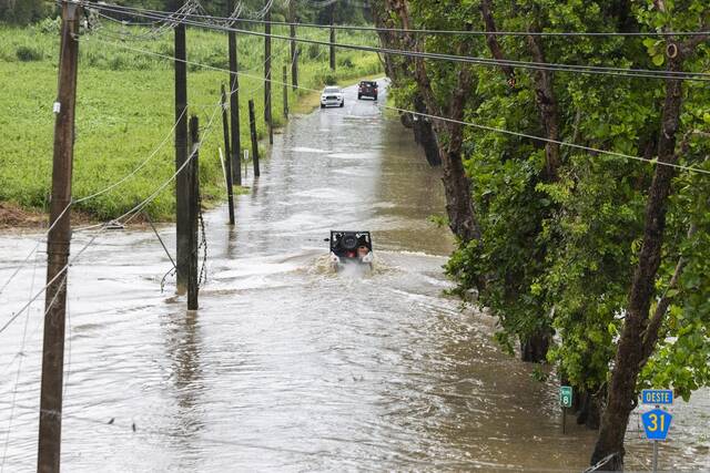
The rain and winds from the outer bands of the storm left about 147,000 customers without power Sunday morning in Puerto Rico, according to Luma Energy, a private company that oversees the transmission and distribution of power on the island. The weather canceled more than 20 flights, officials said.
Swells were also expected to affect portions of the Virgin Islands, Puerto Rico, Hispaniola and the Turks and Caicos Islands during the next couple of days, forecasters said.
The Coast Guard allowed all ports in Puerto Rico and the U.S. Virgin Islands to reopen on Sunday as winds and rains in the area decrease.
Aug 17 2PM AST: As we track #Erin, we are also monitoring two other areas for possible development including a tropical wave in the eastern tropical Atlantic that has a 30 percent chance of development in the next 7 days. Visit https://t.co/tW4KeGdBFb for more updates pic.twitter.com/RaKj9lmYhe
— National Hurricane Center (@NHC_Atlantic) August 17, 2025
A tropical storm warning means tropical storm conditions are expected somewhere within the warning area, and in this case, within 24 hours, the hurricane center said. Heavy rain is still expected across the Virgin Islands and Puerto Rico, with rainfall of 3 to 6 inches, with 8 inches in some isolated areas.
The government of the Bahamas also issued a tropical storm watch for the Southeast Bahamas.
Scientists have linked the rapid intensification of hurricanes in the Atlantic to climate change. Global warming is causing the atmosphere to hold more water vapor and is spiking ocean temperatures, and warmer waters give hurricanes fuel to unleash more rain and strengthen more quickly.