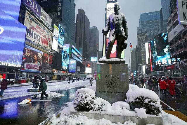
NEW YORK — Long Island will likely be buried in snow by Saturday.
A nor’easter set to blanket the tri-state area and New England over the weekend could drop as much as 36 inches near Islip, according to AccuWeather’s latest predictions Thursday. More likely, though, is a snowfall closer to 12 to 18 inches.
Similar snow totals are expected in Boston and Worcester, Mass.; Providence, R.I.; Hartford and Groton, Conn.; Portsmouth and Manchester, N.H.; and Portland and Bangor, Maine.
.@accuweather forecasters say strong winds will also be a major concern with the developing nor'easter, and some winds could top hurricane force in parts of New England: https://t.co/qJdQXJUxbV pic.twitter.com/eCw4IJa5MH
— Breaking Weather by AccuWeather (@breakingweather) January 27, 2022
“This is going to be an intensifying storm that will produce a lot of wind, which raises concerns for blowing and drifting snow, power outages and blizzard conditions in some areas,” AccuWeather Chief Meteorologist Jonathan Porter said.
The hardest hit areas are expected to stretch from central and eastern Long Island to New England, meteorologists warned.
More southern locations, including New York City, will still likely get blasted with “moderate to heavy snow” at 6 to 12 inches, according to the National Weather Service.
Our 2nd briefing is out for a potential storm system tomorrow night into Saturday night with Winter Storm Watches and Gale Warnings issued. Uncertainty still remains and significant changes are possible.
— NWS New York NY (@NWSNewYorkNY) January 27, 2022
Full briefing here: https://t.co/U4S9WzlXZK#NYwx #NJwx #CTwx pic.twitter.com/q4G4Y0jJ6z
A winter storm watch is already in place from Friday evening to Saturday evening for portions of northeast New Jersey, southern Connecticut and southeast New York.
Gusty wind up to 45 mph could make travel difficult even before the snow accumulates.
More southern cities, such as Philadelphia, Baltimore and Washington, D.C., will likely see just a few inches of snow.
The models remain volatile, but I'm comfortable with these ranges. Like a hurricane, you should always prepare for the worst and hope for the best. Know the numbers could ultimately vary either way. It's also so much about the wind. Tune in for perspective. @weatherchannel pic.twitter.com/LOUbB1FhIx
— Jacqui Jeras (@JacquiJerasTV) January 27, 2022
The storm is expected to fully form off the coast of the Carolinas, then strengthen as it moves north, picking up strong wind and moisture as the pressure plummets, creating a “bomb cyclone.”
But predictions are still hazy, according to meteorologists, and any shift in the storm either closer to the coast or farther into the ocean could have massive effects on the snowfall. A 50-mile shift west could double snowfall totals from New York City to Maryland, although forecasters said Thursday that such an increase seems unlikely.
Winter Storm #Kenan is set to bring big snow, strong winds & coastal flooding to parts of the Northeast this weekend. @wunderground is on now until 4p eastern- make sure you check in with us to find out what you'll see in your town. Some of you will need to get the sleds ready! pic.twitter.com/SEXkrIegYd
— Alex Wilson (@TWCAlexWilson) January 27, 2022
Flooding is possible, particularly in combination with the new moon. Minor to moderate coastal flooding, with a storm surge up to 4 feet, is expected from New Jersey to eastern New England.