


HONOLULU — Typhoon Mawar rumbled through Guam as a powerful Category 4 storm on Thursday, relentlessly lashing the U.S. Pacific island territory with heavy rain, powerful winds, and a dangerous storm surge and knocking out power to many communities where frightened residents hunkered down for the night in homes and shelters.
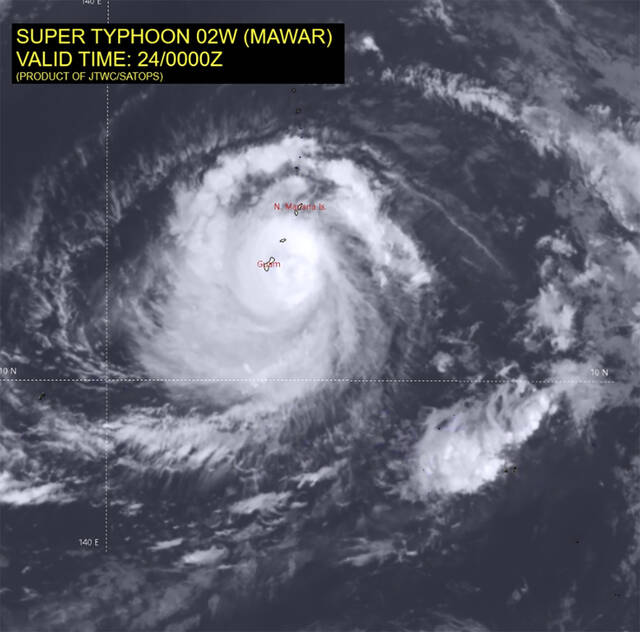
The typhoon’s center passed over the northern tip of Guam on Wednesday evening, the National Weather Service said. It is the strongest storm to hit the territory of over 150,000 people in decades. Its maximum sustained winds remained at 140 mph (225 kph) late Wednesday, and it was forecast to intensify throughout the day Thursday, the weather service said.
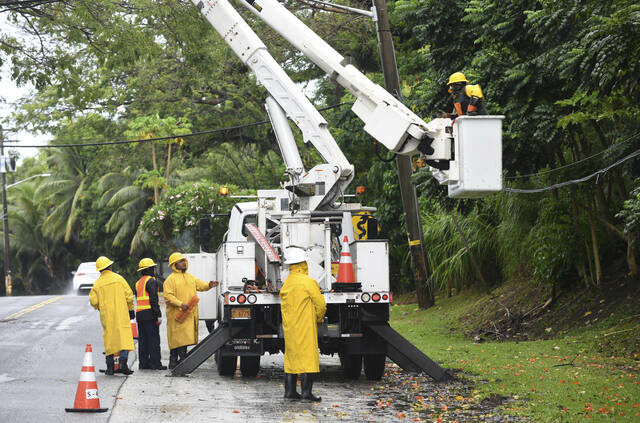
Videos posted on social media showed fallen trees, a flipped pickup truck, solar panels flying through the air, parts of a wall of a multistory hotel crumbling to the ground and exposing rebar, and storm surge and waves crashing through coastal reefs. The early scope of the damage was difficult to ascertain, with power and internet failures making communication with the far-flung island difficult to impossible as the storm carved an excruciatingly slow path.
In a sign of how much help Guam might need, the U.S. Navy ordered the USS Nimitz aircraft carrier strike group to head to the island to assist in the recovery effort, according to a U.S. official. The Nimitz, along with the USS Bunker Hill, a cruiser, and the USS Wayne E. Meyer, a destroyer, were south of Japan en route to Guam, where they were expected to arrive in three or four days, said the official, who spoke on condition of anonymity to discuss ship movements not yet made public.
The storm was moving northwest at 8 mph (13 kph) late Wednesday with a slight increase in speed expected over the next day. It has been a slow-moving typhoon compared to others in the region that have moved upwards of 10 to 15 mph (16 to 25 kph), weather service meteorologist Landon Aydlett said by phone from Guam.
Long-range forecasts place Mawar deep in the Philippine Sea, curving northward but staying northeast of the Philippines, and it’s possible the storm could regain super typhoon status, with maximum sustained winds of 150 mph (241 kph) or greater, he said.
The storm clipped the far northern part of Guam, but otherwise it was in the channel between the island and its neighbor to the north, Rota, Aydlett said. Peak winds at the weather service office in Guam reached 105 mph (169 kph), but the office later lost its wind sensors, he said. The building was vibrating with a “constant, low rumbling,” and its doors and windows were shaking, he said.
“We have the peak conditions going on for a couple more hours. I think thrashing is the word I would use,” he said. “There are trees everywhere at this point. Daylight tomorrow is really going to be a shock to a lot of people.”
Lightning became an increasing threat as conditions deteriorated as night wore on, the weather service reported. A flash flood warning was in effect Thursday morning.
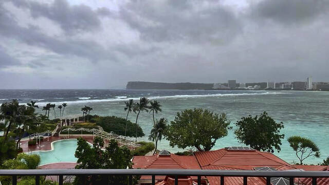
In Tumon, on the island’s northeastern shore, powerful winds tore a granite countertop from a hotel’s outdoor bar and tossed it four feet in the air. Guests scrambled to stack chairs against hotel doors being blown in from the gusts as windows buckled and creaked.
The weather service said the storm made landfall at around 9 p.m. Wednesday in Guam, which is about 3,800 miles (6,115 kilometers) west of Hawaii and 1,600 miles (1,575 kilometers) east of the Manila, the capital of the Philippines.
Rota, an island in the U.S. Commonwealth of the Northern Mariana Islands, was also under a typhoon warning. Tinian and Saipan, in the Northern Marianas, were under tropical storm warnings. Some people in those areas have been living in temporary shelters or tents since Category 5 Super Typhoon Yutu in 2018.
The weather service warned of an extremely dangerous and life-threatening situation in Guam and said people should take cover and remain in shelter for the next few hours.
“This is going to be kind of a long night. It’s going to be scary because there’s no electricity unless you have a generator,” Brandon Aydlett — a science and operations officer for the weather service, and Landon Aydlett’s twin brother — said in a Facebook Live broadcast. “Reassure your children. It’s going to be a little bit scary as we go later into the night. You can hear the sounds: The winds are howling, things are breaking. Just be together, talk to each other and things will slow down toward midnight and continuing into Thursday morning.”
He urged people to stay in shelters and encouraged them to try to get as much sleep as possible ahead of “a long day tomorrow as we start the recovery process.”
Many communities on the 212-square-mile (549-square-kilometer) island had lost power by afternoon, and some to the south had lost water service. A flash flood warning was issued for the entire island as forecasters predicted as much as 25 inches (64 centimeters) of rain in addition to a life-threatening storm surge of 4 to 6 feet (1.2 to 2 meters).
Ahead of the storm, Guam Gov. Lou Leon Guerrero ordered those living in coastal, low-lying and flood-prone areas to evacuate to higher ground. The highest point on the island is Mount Lamlam in the southwest at 1,334 feet (406 meters). But much of the beachfront tourist district of Tamuning, where many resorts are located, is close to sea level.
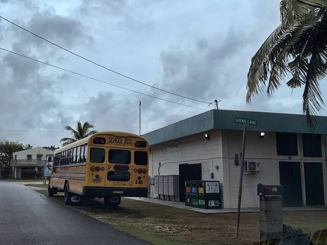
School buses picked up residents at island community centers and took them to 11 elementary schools outfitted as shelters. Civic workers in villages warned residents to secure loose objects in their yards and seek shelter immediately. Some spread the word by megaphone, while others turned to social media. Power flickered off and on as the rain and wind intensified, and officials said nearly 900 people were in shelters.
Guerrero said an emergency declaration approved by President Joe Biden will support the mobilization of resources into Guam, which is “especially crucial given our distance from the continental U.S.”
In low-lying Agat along the southern coast, resident Reuel Drilon said nearly every home in the village has a mango tree, which officials warned could become roadblocks and deadly flying projectiles.
“A lot of folks are keeping their eyes on trees,” he said before the storm hit.
Guam is a crucial hub for U.S. forces in the Pacific, and the Department of Defense controls about a third of the island. Rear Adm. Benjamin Nicholson, Joint Region Marianas commander, authorized the evacuation of defense personnel, dependents and employees from areas that were expected to be affected.
The military said it moved its ships out to sea as a standard precaution. It sent its aircraft off the island or placed them in protective hangars. Any personnel remaining on the island were sheltering in place. About 6,800 U.S. service members are assigned to Guam, according to the Pentagon.